Aerial Surveillance
In order to prevent illegal or accidental pollution most Bonn Agreement Contracting Parties undertake aerial surveillance to enforce maritime pollution rules and standards.

Most countries operate routine counter pollution flights focused on pollution from shipping and enforcement of the International Maritime Organisation (IMO) MARPOL convention, which designates the North Sea as a special area in which the adoption of special mandatory methods for the prevention of sea pollution by oil is required. Some countries however have adopted the use of satellite images, provided by the European Maritime Safety Agency, to provide a first alert for oil pollution rather than routine patrolling.
The Bonn Agreement also operates a coordinated Tour d’Horizon programme for aerial surveillance of offshore oil and gas installations. Patrol flights by individual countries, covering predetermined routes, are coordinated during the year in order to provide maximum coverage.
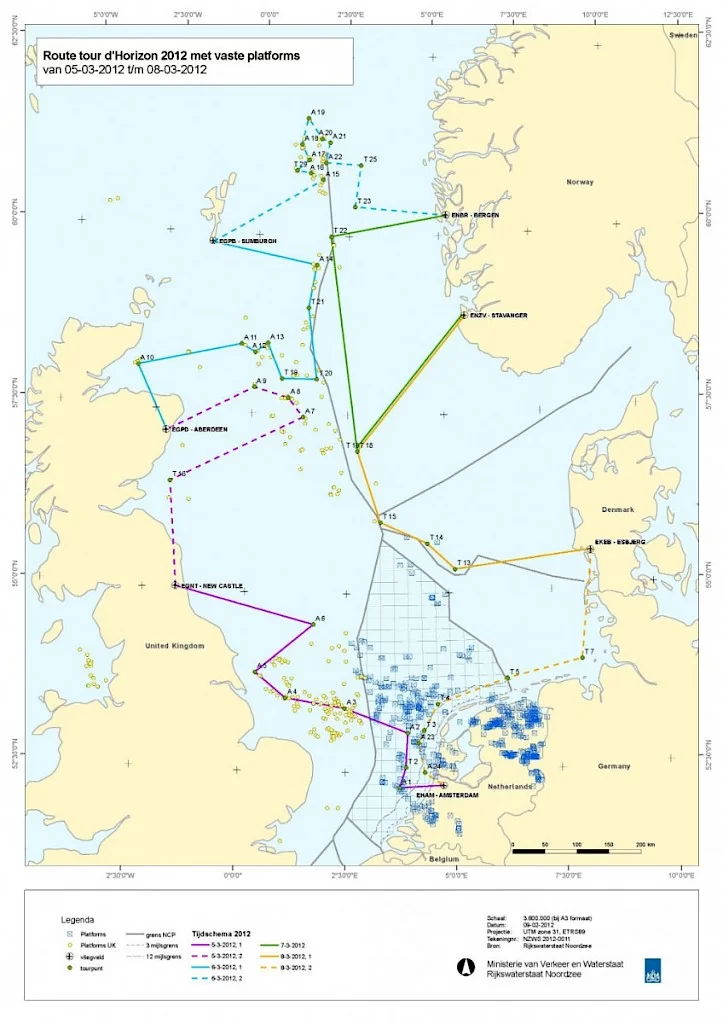
All aerial operations whether they be routine patrols or Tour d’Horizon missions are undertaken in line with the Bonn Agreement Aerial Operations Handbook (AOH). The AOH ensures aircrew follow the same procedures when planning and conducting counter-pollution flights and gathering evidence in the case of pollution incidents. The AOH is supported by the BAOAC Photo Atlas which comprises an array of exemplary photos of aerial observations of different types of oil slicks from accidental or illegal discharges from ships or oil rigs, including SLAR and IR/UV images, together with explanatory texts.
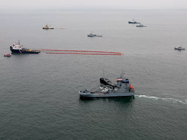
Aerial Surveillance exercises or CEPCOs (Co-ordinated Extended Pollution Control Operations), where aircraft from different countries undertake a coordinated exercise in a specific area over 24 hours, or a week for a SuperCEPCO, are held regularly to ensure all aircrews are familiar with joint operations.
All data on spills identified during aerial surveillance operations and CEPCOs are recorded centrally by the Bonn Agreement and published each year in the Annual Report on Aerial Surveillance (Earlier reports (from 1986) can be obtained from the Bonn Agreement Secretariat). This information allows the organisation to track trends in amounts and types of spills. In recent years the Bonn Agreement has also produced an Aerial Surveillance fact sheet to make the data more accessible. The data on the location and size of the oil spills identified in the Bonn Agreement Aerial Surveillance programme for each year is outlined in the maps below.
Downloads


Next In This Section
Exercises
Bonn Agreement countries need to meet international and European obligations to ensure that they are prepared to respond in the event of pollution incidents or to a threat of pollution. Contracting Parties work together to ensure the knowledge, planning, training and operational testing of emergency systems is in place to ensure effective preparedness.
Read